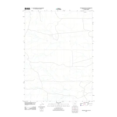
2012 Map of Antelope Knoll NE
USGS Topo · Published 2012About this map
Little Dry Creek meanders across the southern reaches of this landscape in Sweetwater County, Wyoming. The terrain is largely defined by the ephemeral drainage patterns typical of this high desert region, where the sparse network of watercourses dictates the historical routes of travel and land use. The presence of Tenneco Road in the northern portion of the map indicates industrial access common to the resource-rich basins of Wyoming during the early twenty-first century. This survey by the U.S. Geological Survey provides a precise view of the topography and infrastructure, showing the intersection of natural features and modern transit corridors in this open country.
Find a feature on this map
2 named features on this map. Tap any name to fly to it.
Don’t see what you’re looking for? This feature index may not catch every label — zoom into the map to look around manually.
Map Details
Editions of this 2012 Antelope Knoll NE Map
This is the sole edition of this map. No revisions or reprints were ever made.
Other maps of this area

1954 · Rock Springs
USGS Topo · 1:250,000

1957 · Mc Kinnon Junction
USGS Topo · 1:62,500

1958 · Rock Springs
USGS Topo · 1:250,000

1961 · Little America
USGS Topo · 1:24,000

1961 · Granger
USGS Topo · 1:24,000

1961 · Bryan
USGS Topo · 1:24,000

1962 · Rock Springs
USGS Topo · 1:250,000

1964 · Antelope Knoll NE
USGS Topo · 1:24,000

1964 · Antelope Knoll
USGS Topo · 1:24,000

1964 · Winter Fat Reservoir
USGS Topo · 1:24,000