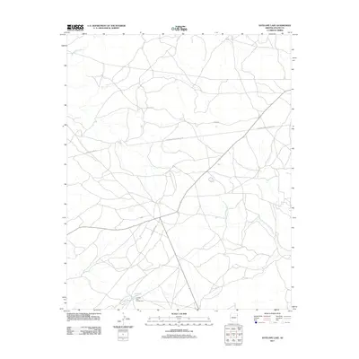
2011 Map of Antelope Lake
USGS Topo · Published 2011About this map
Antelope Lake and its accompanying Antelope Lake Campground serve as central points of interest within this high-desert landscape. The terrain is defined by a network of drainage systems, including the West Fork Black Creek and Wide Ruin Wash, which move through the sparsely developed region. These natural water features contrast with the industrial infrastructure of the modern era, most notably the prominent Transwestern Pipeline Cord that traverses the northern half of the area.
Find a feature on this map
9 named features on this map. Tap any name to fly to it.
Don’t see what you’re looking for? This feature index may not catch every label — zoom into the map to look around manually.
Map Details
Editions of this 2011 Antelope Lake Map
This is the sole edition of this map. No revisions or reprints were ever made.
Other maps of this area

1886 · Fort Defiance
USGS Topo · 1:250,000

1892 · Fort Defiance
USGS Topo · 1:250,000

1954 · Gallup
USGS Topo · 1:250,000

1955 · Zith-Tusayan Butte 3 NW
USGS Topo · 1:24,000

1955 · Zith-Tusayan Butte 4 NW
USGS Topo · 1:24,000

1955 · Zith-Tusayan Butte 3 NE
USGS Topo · 1:24,000

1958 · Gallup
USGS Topo · 1:250,000

1959 · Gallup
USGS Topo · 1:250,000

1962 · Gallup
USGS Topo · 1:250,000

1967 · Gallup
USGS Topo · 1:250,000