
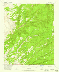
1955 Map of Zith-Tusayan Butte 3 NW
USGS Topo · Published 1957About this map
Kinlichee and the surrounding high-plateau country of the Navajo Indian Reservation are documented here in the mid-1950s. This preliminary study shows a landscape defined by seasonal watercourses and high-elevation landforms, including the prominent Choyojdalid Hill. Life in this part of Apache County is centered on the Kinlichee School and the Cross Canyon Trading Post, the latter serving as a vital hub for local commerce and communication. Transportation is anchored by the Indian Service Road 3, which cuts east-west across the terrain. Hydrological management is evident through a series of features such as a Gaging Sta along Kinlichee Creek, as well as a Reservoir and multiple Dams designed to capture runoff in a semi-arid environment. The network of unimproved roads and trails suggests a community deeply integrated with the geography of Fish Wash and Burnt Piñon Wash.
Find a feature on this map
13 named features on this map. Tap any name to fly to it.
Don’t see what you’re looking for? This feature index may not catch every label — zoom into the map to look around manually.
Map Details
Editions of this 1955 Zith-Tusayan Butte 3 NW Map
This is the sole edition of this map. No revisions or reprints were ever made.
Other maps of this area

1886 · Fort Defiance
USGS Topo · 1:250,000

1892 · Fort Defiance
USGS Topo · 1:250,000

1954 · Gallup
USGS Topo · 1:250,000

1955 · Zith-Tusayan Butte 2 SE
USGS Topo · 1:24,000

1955 · Zith-Tusayan Butte 2 SW
USGS Topo · 1:24,000

1955 · Zith-Tusayan Butte 3 NE
USGS Topo · 1:24,000
1955 · Nazlini
USGS Topo · 1:62,500

1958 · Gallup
USGS Topo · 1:250,000

1959 · Gallup
USGS Topo · 1:250,000

1962 · Gallup
USGS Topo · 1:250,000