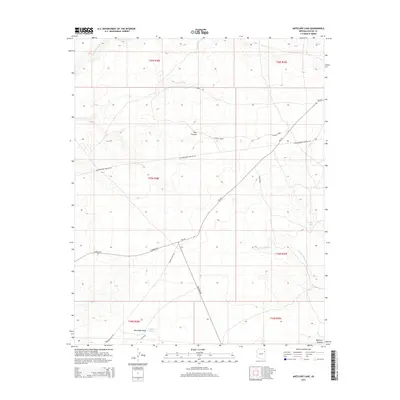
2014 Map of Antelope Lake
USGS Topo · Published 2014About this map
Antelope Lake sits at the southern edge of this high-elevation landscape, where the seasonal drainages of the Defiance Plateau carve through a terrain of canyons and washes. The map reflects a modern infrastructure overlay on traditional tribal lands, dominated by the long diagonal of the Transwestern Pipeline Rd and a network of Bureau of Indian Affairs routes like Bia-201. These roads connect isolated landmarks such as Roanhorse and traverse the breaks of Pine Canyon.
Find a feature on this map
22 named features on this map. Tap any name to fly to it.
Don’t see what you’re looking for? This feature index may not catch every label — zoom into the map to look around manually.
Map Details
Editions of this 2014 Antelope Lake Map
This is the sole edition of this map. No revisions or reprints were ever made.
Other maps of this area

1886 · Fort Defiance
USGS Topo · 1:250,000

1892 · Fort Defiance
USGS Topo · 1:250,000

1954 · Gallup
USGS Topo · 1:250,000

1955 · Zith-Tusayan Butte 3 NW
USGS Topo · 1:24,000

1955 · Zith-Tusayan Butte 4 NW
USGS Topo · 1:24,000

1955 · Zith-Tusayan Butte 3 NE
USGS Topo · 1:24,000

1958 · Gallup
USGS Topo · 1:250,000

1959 · Gallup
USGS Topo · 1:250,000

1962 · Gallup
USGS Topo · 1:250,000

1967 · Gallup
USGS Topo · 1:250,000