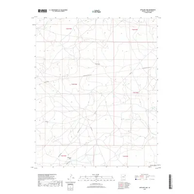
2018 Map of Antelope Lake
USGS Topo · Published 2018About this map
The Defiance Plateau high country defines this 2018 survey, where the drainages of Wide Ruin Wash and Pine Canyon carve through the arid terrain of Apache County. This high-desert landscape is marked by a complex network of utility and access corridors, including the Transwestern Pipeline Co Rd and Indian Rte 9335. Small bodies of water like Antelope Lake and Hidden Lake provide vital collection points in an environment dominated by seasonal flow, as seen in the paths of W Fork Black Cr and Oak Ridge Wash. The map reveals a land structured by traditional township and range divisions, where infrastructure like Summit Rd and Banana Wash Rd facilitates movement across the expansive plateaus of the Fort Defiance Agency region.
Find a feature on this map
19 named features on this map. Tap any name to fly to it.
Don’t see what you’re looking for? This feature index may not catch every label — zoom into the map to look around manually.
Map Details
Editions of this 2018 Antelope Lake Map
This is the sole edition of this map. No revisions or reprints were ever made.
Other maps of this area

1886 · Fort Defiance
USGS Topo · 1:250,000

1892 · Fort Defiance
USGS Topo · 1:250,000

1954 · Gallup
USGS Topo · 1:250,000

1955 · Zith-Tusayan Butte 3 NW
USGS Topo · 1:24,000

1955 · Zith-Tusayan Butte 4 NW
USGS Topo · 1:24,000

1955 · Zith-Tusayan Butte 3 NE
USGS Topo · 1:24,000

1958 · Gallup
USGS Topo · 1:250,000

1959 · Gallup
USGS Topo · 1:250,000

1962 · Gallup
USGS Topo · 1:250,000

1967 · Gallup
USGS Topo · 1:250,000