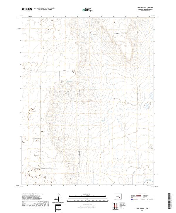
2022 Map of Antelope Mesa
USGS Topo · Published 2022About this map
Antelope Mesa dominates the northern landscape of this Crowley County region, a high ground defined by its gradual slopes and sparse water sources. The map highlights the essential water management systems of the high plains, most notably the Colorado Canal cutting through the southeastern corner. This vital artery represents the lifeblood of agricultural development in the arid Colorado interior, where natural water is limited to features like Bluff Springs and the isolated Tennessee Pond. A rigid grid of county roads, including Olney Springs Rd and Co Rd R, divides the landscape into township and range sections, illustrating the organized land distribution of the American West. The survey detail provides a clear look at the sparse, rural character of the area, where the vast open terrain is marked primarily by these infrequent watering points and the infrastructure of irrigation.
Find a feature on this map
18 named features on this map. Tap any name to fly to it.
Don’t see what you’re looking for? This feature index may not catch every label — zoom into the map to look around manually.
Map Details
Editions of this 2022 Antelope Mesa Map
This is the sole edition of this map. No revisions or reprints were ever made.
Other maps of this area

1891 · Catlin
USGS Topo · 1:125,000

1891 · Nepesta
USGS Topo · 1:125,000

1893 · Nepesta
USGS Topo · 1:125,000

1893 · Catlin
USGS Topo · 1:125,000

1904 · Nepesta
USGS Topo · 1:125,000

1954 · Olney Springs
USGS Topo · 1:24,000

1954 · Ordway
USGS Topo · 1:24,000

1954 · Lamar
USGS Topo · 1:250,000

1954 · Pueblo
USGS Topo · 1:250,000

1957 · Pueblo
USGS Topo · 1:250,000