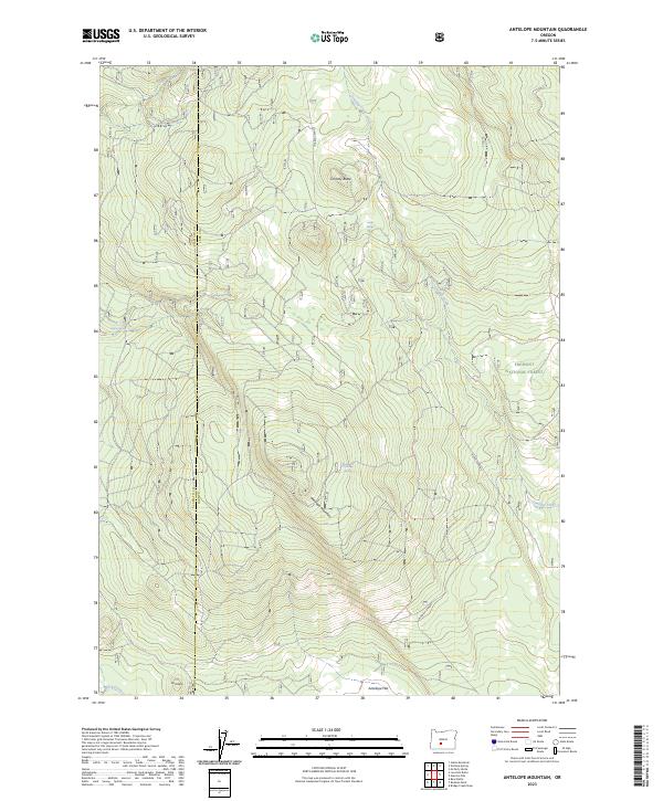
2023 Map of Antelope Mountain
USGS Topo · Published 2023About this map
The high timberlands and volcanic peaks of the Fremont National Forest dominate this landscape along the border of Klamath and Lake Counties. The terrain is defined by prominent elevations such as Antelope Mountain and Timothy Butte, with the lower southern reaches opening into Antelope Flat. This modern survey illustrates a network of critical water sources essential to the region's ecology and history, including Mowich Spring, Jungle Spring, and Antelope Spring. While the area remains largely undeveloped, the mapping of drainage patterns like Timothy Creek and Rock Creek alongside the Forest Service's 2516 road network provides a detailed look at how this high-altitude forest is managed and accessed. The placement of the Klamath Co Lake Co boundary line across the central peaks highlights the remote jurisdictional intersections in this part of Oregon.
Find a feature on this map
17 named features on this map. Tap any name to fly to it.
Don’t see what you’re looking for? This feature index may not catch every label — zoom into the map to look around manually.
Map Details
Editions of this 2023 Antelope Mountain Map
This is the sole edition of this map. No revisions or reprints were ever made.
Other maps of this area

1955 · Crescent
USGS Topo · 1:250,000

1957 · Crescent
USGS Topo · 1:250,000

1958 · Crescent
USGS Topo · 1:250,000

1968 · Location Butte
USGS Topo · 1:24,000

1968 · Rodman Rock
USGS Topo · 1:24,000

1968 · Oatman Flat
USGS Topo · 1:24,000
1968 · Antelope Mtn
USGS Topo · 1:24,000
1968 · Bear Butte
USGS Topo · 1:24,000
1968 · Bridge Creek Draw
USGS Topo · 1:24,000

1970 · Crescent
USGS Topo · 1:250,000