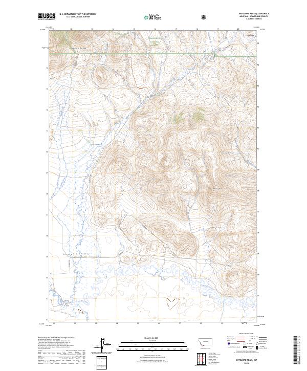
2024 Map of Antelope Peak
USGS Topo · Published 2024About this map
Antelope Peak stands as a prominent high point in this high-altitude landscape where the Snowcrest Range meets the expansive Centennial Valley. This 2024 survey captures a critical ecological intersection, dominated by the sprawling boundaries of the Red Rock Lakes National Wildlife Refuge and portions of the Beaverhead National Forest. The hydrological network is defined by the Red Rock River and its numerous tributaries, including Mohican Creek, West Creek, and Middle Creek, which carve through the valley floor.
Find a feature on this map
28 named features on this map. Tap any name to fly to it.
Don’t see what you’re looking for? This feature index may not catch every label — zoom into the map to look around manually.
Map Details
Editions of this 2024 Antelope Peak Map
This is the sole edition of this map. No revisions or reprints were ever made.
Other maps of this area

1950 · Lower Red Rock Lake
USGS Topo · 1:62,500

1950 · Monument Ridge
USGS Topo · 1:62,500

1955 · Dubois
USGS Topo · 1:250,000

1955 · Ashton
USGS Topo · 1:250,000

1958 · Dubois
USGS Topo · 1:250,000

1958 · Ashton
USGS Topo · 1:250,000

1960 · Ashton
USGS Topo · 1:250,000

1968 · Stonehouse Mountain
USGS Topo · 1:24,000

1968 · Corral Creek
USGS Topo · 1:24,000

1968 · Big Table Mountain
USGS Topo · 1:24,000