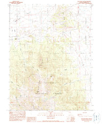
1990 Map of Antelope Peak
USGS Topo · Published 1990About this map
Toiyabe National Forest dominates the central and southern reaches of this landscape, where the Monitor Range rises between two significant basins. To the west lies Monitor Valley, while the eastern flank transitions into Antelope Valley. The rugged topography is anchored by Antelope Peak and Summit Mountain, with numerous drainages like Willow Creek and Pedlar Creek carving through the slopes. This 1990 provisional survey captures the area's resource-based character, noting a Gravel Pit and several Prospects tucked into the Twin Spring Hills. The lone named habitation, Willows Ranch, is situated near the junction of mountain runoff and the valley floor, highlighting the importance of water sources like Dagget Spring in this high-desert environment.
Find a feature on this map
23 named features on this map. Tap any name to fly to it.
Don’t see what you’re looking for? This feature index may not catch every label — zoom into the map to look around manually.
Map Details
Editions of this 1990 Antelope Peak Map
This is the sole edition of this map. No revisions or reprints were ever made.
Other maps of this area

1926 · Roberts Mountains
USGS Topo · 1:250,000

1929 · Roberts Mountains
USGS Topo · 1:250,000

1955 · Millett
USGS Topo · 1:250,000

1956 · Bartine Ranch
USGS Topo · 1:62,500

1956 · Antelope Peak
USGS Topo · 1:62,500

1956 · Ackerman Canyon
USGS Topo · 1:62,500

1959 · Millett
USGS Topo · 1:250,000

1960 · Hickison Summit
USGS Topo · 1:62,500

1978 · Summit Mountain
USGS Topo · 1:100,000

1979 · Simpson Park Mtns
USGS Topo · 1:100,000