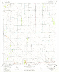
1981 Map of Antelope Peak NE
USGS Topo · Published 1982About this map
The Ak-Chin Indian Reservation occupies the northern half of this Pinal County landscape, which by the early 1980s was defined by a geometric grid of agriculture and infrastructure. The irrigation-dependent terrain is marked by numerous water tanks and wells, supporting life along the Vekol Wash. Settlement is concentrated at Peters Corner and near the Casa Grande Turbine Station, reflecting a shift toward modernized utilities and industrial power in the desert.
Find a feature on this map
21 named features on this map. Tap any name to fly to it.
Don’t see what you’re looking for? This feature index may not catch every label — zoom into the map to look around manually.
Map Details
Editions of this 1981 Antelope Peak NE Map
2 editions found
Other maps of this area

1913 · Maricopa
USGS Topo · 1:62,500

1914 · Gila Butte
USGS Topo · 1:62,500

1915 · Maricopa
USGS Topo · 1:62,500

1917 · Gila Butte
USGS Topo · 1:62,500

1922 · Casa Grande
USGS Topo · 1:62,500

1924 · Casa Grande
USGS Topo · 1:62,500

1946 · Antelope Peak
USGS Topo · 1:62,500

1948 · Antelope Peak
USGS Topo · 1:62,500

1952 · Maricopa
USGS Topo · 1:24,000

1952 · Sacaton Butte
USGS Topo · 1:24,000