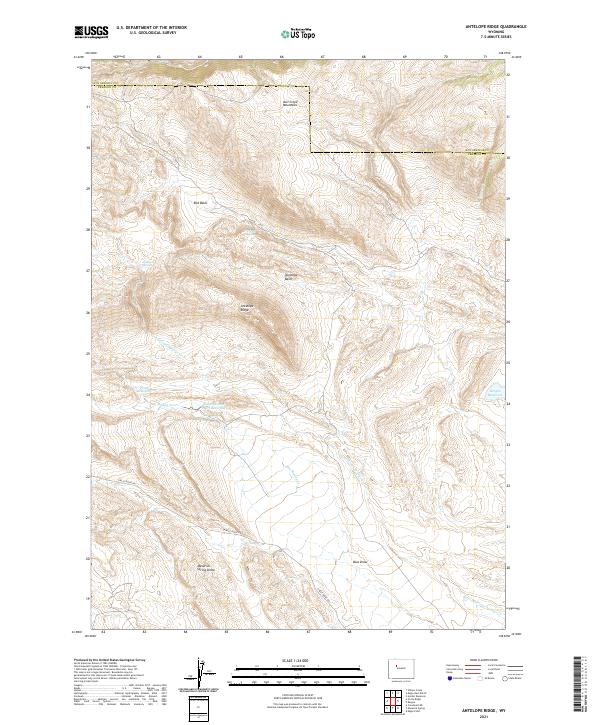
2021 Map of Antelope Ridge
USGS Topo · Published 2021About this map
The Owl Creek Mountains dominate the northern terrain of this central Wyoming landscape, where the high desert environment is defined by its drainage patterns and geologic formations. Settled within the Hot Springs and Fremont County borderlands, the area is characterized by significant topographical features such as the Maverick Spring Dome and the high elevations of Antelope Ridge. Water management in this arid region is evidenced by the presence of Pearl Reservoir and Bargee Reservoir, which capture runoff from intermittent streams like Dry Muddy Cr. Local transportation is centered on Circle Ridge RD, providing access across the varied basins, including Red Basin and Antelope Basin. This 2021 study documents the contemporary state of the range, including named water sources such as Antelope Springs and Trickle Spring that have long been vital to land use in the high plains.
Find a feature on this map
22 named features on this map. Tap any name to fly to it.
Don’t see what you’re looking for? This feature index may not catch every label — zoom into the map to look around manually.
Map Details
Editions of this 2021 Antelope Ridge Map
This is the sole edition of this map. No revisions or reprints were ever made.
Other maps of this area

1904 · Kirwin
USGS Topo · 1:125,000

1906 · Kirwin
USGS Topo · 1:125,000

1951 · Eagle Point
USGS Topo · 1:24,000

1951 · Maverick Spring
USGS Topo · 1:24,000

1952 · Antelope Ridge
USGS Topo · 1:24,000

1952 · Crowheart NE
USGS Topo · 1:24,000

1952 · Bargee
USGS Topo · 1:24,000

1955 · Thermopolis
USGS Topo · 1:250,000

1957 · Crowheart NE
USGS Topo · 1:24,000

1958 · Thermopolis
USGS Topo · 1:250,000