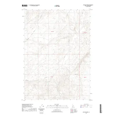
2020 Map of Antelope Spring
USGS Topo · Published 2020About this map
Antelope Spring sits at the heart of this high-desert landscape in Owyhee County, where a network of seasonal drainages and named gulches defines the local geography. The map reveals a complex system of watercourses including Hart Cr, Browns Cr, and Buckaroo Cr, which cut through the high plateau. These features, along with Hogpen Gulch, indicate a long history of land use centered on water access in an arid environment. Transportation across this remote terrain is marked by specific historic routes such as the Bachman Grade and Triangle Rd, while Alder Creek Rd skirts the southern portion near Alder Cr. This modern survey by the U.S. Geological Survey documents the enduring hydrography and fundamental road network of the Owyhee backcountry, providing essential context for understanding the region's ranching and topographical history.
Find a feature on this map
17 named features on this map. Tap any name to fly to it.
Don’t see what you’re looking for? This feature index may not catch every label — zoom into the map to look around manually.
Map Details
Editions of this 2020 Antelope Spring Map
This is the sole edition of this map. No revisions or reprints were ever made.
Other maps of this area

1892 · Bisuka
USGS Topo · 1:125,000

1892 · Silver City
USGS Topo · 1:125,000

1894 · Bisuka
USGS Topo · 1:125,000

1894 · Silver City
USGS Topo · 1:125,000

1898 · Silver City
USGS Topo · 1:125,000

1948 · Castle Butte
USGS Topo · 1:24,000

1949 · Oreana
USGS Topo · 1:62,500
1949 · Oreana
USGS Topo · 1:24,000
1950 · Oreana
USGS Topo · 1:24,000

1955 · Jordan Valley
USGS Topo · 1:250,000