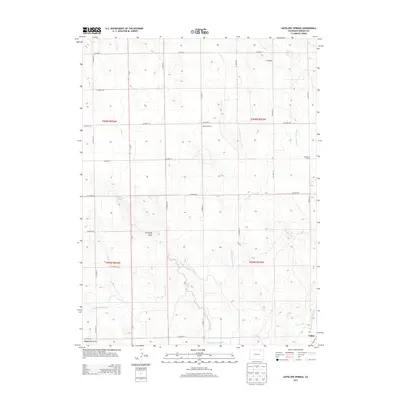
2013 Map of Antelope Springs
USGS Topo · Published 2013About this map
Riverside Intake Canal snakes through the high plains of Morgan County, defining the agricultural character of this landscape in the early 21st century. The map centers on a grid of county roads that service remote outposts and former educational sites such as Gilliland School and Brammer School. The presence of these named schoolhouses alongside modern irrigation features like Snyder Canal and N Sterling Canal illustrates the long-standing efforts to manage water in this arid region. Near the southern boundary, the settlement of Union sits at the junction of the local rail and road network. Natural drainages like Antelope Draw and Dead Horse Draw provide topographic relief against the expansive terrain, while Antelope Springs offers a rare named water source amidst the rolling rangeland.
Find a feature on this map
29 named features on this map. Tap any name to fly to it.
Don’t see what you’re looking for? This feature index may not catch every label — zoom into the map to look around manually.
Map Details
Editions of this 2013 Antelope Springs Map
This is the sole edition of this map. No revisions or reprints were ever made.
Other maps of this area

1951 · Dead Horse Springs
USGS Topo · 1:24,000

1951 · Willard
USGS Topo · 1:24,000

1951 · Messex
USGS Topo · 1:24,000

1951 · Brush West
USGS Topo · 1:24,000

1951 · Antelope Springs
USGS Topo · 1:24,000

1951 · Merino SW
USGS Topo · 1:24,000

1951 · Brush East
USGS Topo · 1:24,000

1954 · Sterling
USGS Topo · 1:250,000

1958 · Sterling
USGS Topo · 1:250,000

1971 · Brush East
USGS Topo · 1:24,000