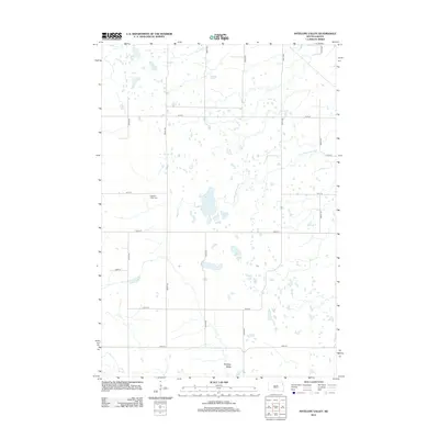
2012 Map of Antelope Valley
USGS Topo · Published 2012About this map
Antelope Valley defines this portion of the South Dakota landscape, characterized by a high-plains geography where water determines the pattern of land use. The S Fork Whetstone River winds through the eastern section of the quadrangle, while the interior is dotted with numerous small wetlands and larger bodies like Myers Lake and a portion of Twin Lakes. This 2012 survey illustrates a modern grid of county roads, including 463rd Ave and 151st St, which segment the terrain into agricultural blocks.
Find a feature on this map
18 named features on this map. Tap any name to fly to it.
Don’t see what you’re looking for? This feature index may not catch every label — zoom into the map to look around manually.
Map Details
Editions of this 2012 Antelope Valley Map
This is the sole edition of this map. No revisions or reprints were ever made.
Other maps of this area

1953 · Milbank
USGS Topo · 1:250,000

1958 · Milbank
USGS Topo · 1:250,000

1970 · Summit
USGS Topo · 1:24,000

1970 · Still Lake SE
USGS Topo · 1:24,000

1970 · Marvin
USGS Topo · 1:24,000

1970 · Still Lake NE
USGS Topo · 1:24,000

1971 · Corona
USGS Topo · 1:24,000

1973 · Twin Brooks
USGS Topo · 1:24,000

1973 · Stockholm
USGS Topo · 1:24,000
1973 · South Shore
USGS Topo · 1:24,000