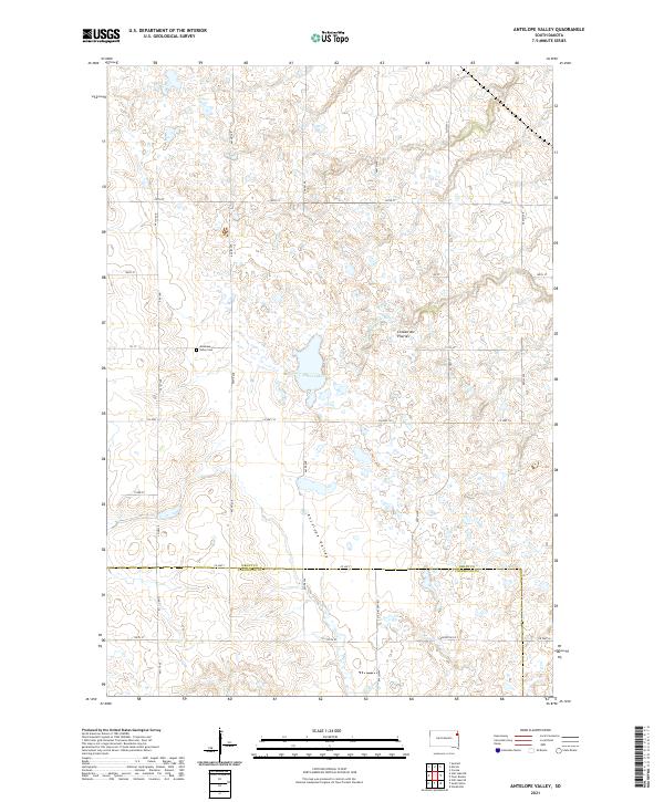
2021 Map of Antelope Valley
USGS Topo · Published 2021About this map
Coteau des Prairies defines the geography of this northeastern South Dakota landscape, where the plateau's complex glacial topography creates a dense network of seasonal basins and wetlands. The central depression of Antelope Valley serves as a natural corridor between the higher elevations, dominated by Myers Lake and the headwaters of the S Fork Whetstone River. This 2021 survey illustrates a sparse rural settlement pattern, where the township and range grid is etched into the terrain by local routes like Co Hwy 14 and 462nd Ave. For local historians, the Antelope Valley Cem stands as a primary landmark along 151 St, situated near the intersection of several historical township boundaries. The map also clearly delineates the border between Grant Co and Codington Co, showing how county roads like Codington Co 2 integrate into the regional transport network.
Find a feature on this map
32 named features on this map. Tap any name to fly to it.
Don’t see what you’re looking for? This feature index may not catch every label — zoom into the map to look around manually.
Map Details
Editions of this 2021 Antelope Valley Map
This is the sole edition of this map. No revisions or reprints were ever made.
Other maps of this area

1953 · Milbank
USGS Topo · 1:250,000

1958 · Milbank
USGS Topo · 1:250,000

1970 · Summit
USGS Topo · 1:24,000

1970 · Still Lake SE
USGS Topo · 1:24,000

1970 · Marvin
USGS Topo · 1:24,000

1970 · Still Lake NE
USGS Topo · 1:24,000

1971 · Corona
USGS Topo · 1:24,000

1973 · Twin Brooks
USGS Topo · 1:24,000

1973 · Stockholm
USGS Topo · 1:24,000
1973 · South Shore
USGS Topo · 1:24,000