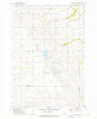
1973 Map of Antelope Valley
USGS Topo · Published 1976About this map
The rolling prairies of Grant and Codington counties are defined here by a network of drainage and conservation lands in the mid-1970s. The Antelope and Osceola townships are characterized by numerous small depressions and wetlands, many of which are preserved within the National Waterfowl Production Area. The Chicago Milwaukee St Paul and Pacific railroad cuts through the northeastern corner, following the natural contour of the land near Twin Lakes. Local civic life and history are anchored at the Antelope Valley Cem and a solitary Townhall at the section crossroads, while the Mazeppa State Public Shooting Area suggests the importance of the landscape for local recreation and wildlife management during this era.
Find a feature on this map
16 named features on this map. Tap any name to fly to it.
Don’t see what you’re looking for? This feature index may not catch every label — zoom into the map to look around manually.
Map Details
Editions of this 1973 Antelope Valley Map
This is the sole edition of this map. No revisions or reprints were ever made.
Other maps of this area

1953 · Milbank
USGS Topo · 1:250,000

1958 · Milbank
USGS Topo · 1:250,000

1970 · Summit
USGS Topo · 1:24,000

1970 · Still Lake SE
USGS Topo · 1:24,000

1970 · Marvin
USGS Topo · 1:24,000

1970 · Still Lake NE
USGS Topo · 1:24,000

1971 · Corona
USGS Topo · 1:24,000

1973 · Twin Brooks
USGS Topo · 1:24,000

1973 · Stockholm
USGS Topo · 1:24,000
1973 · South Shore
USGS Topo · 1:24,000