1987 Map of Antelope
USGS Topo · Published 1988About this map
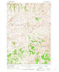
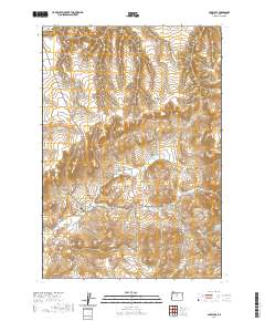
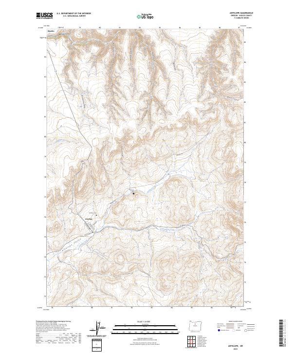
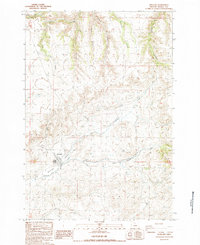
Antelope sits at the convergence of high-desert drainage systems in this late 1980s topographical study of Wasco County. The town is framed by the confluence of Valley Creek and Antelope Creek, situated amidst a complex network of canyons and hollows including Fraser Canyon and Grub Hollow. This era of the landscape is marked by both its agricultural infrastructure and modern utilities, featuring the Antelope Levee, a Radio Facility, and various Storage Tanks and bins. To the southeast, the isolated settlement of Cold Camp appears near several springs, illustrating the sparse but persistent habitation patterns of the region. The map provides a look at the interplay between natural landforms like Little Pine and human modifications such as a Borrow Pit, capturing the area as it transitioned through the mid-1980s before any later-century developments.
Find a feature on this map
25 named features on this map. Tap any name to fly to it.
Don’t see what you’re looking for? This feature index may not catch every label — zoom into the map to look around manually.
Map Details
Editions of this 1987 Antelope Map
This is the sole edition of this map. No revisions or reprints were ever made.
Historical Maps of Antelope Through Time
7 maps found