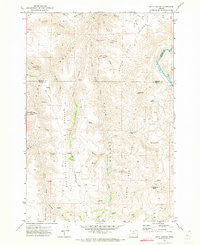
1971 Map of Bath Canyon
USGS Topo · Published 1973About this map
John Day River flows along the eastern boundary of this high-plateau landscape, where the borders of Sherman, Wasco, and Gilliam counties converge. The terrain is defined by a series of deep, parallel drainages including Bath Canyon Creek, Long Hollow Creek, and Dove Hollow that carve through the volcanic soils toward the river. This early 1970s survey illustrates a region dominated by ranching and resource management, with numerous named water sources such as Rattlesnake Spring and Rock Spring essential for livestock and local homesteads.
Find a feature on this map
31 named features on this map. Tap any name to fly to it.
Don’t see what you’re looking for? This feature index may not catch every label — zoom into the map to look around manually.
Map Details
Editions of this 1971 Bath Canyon Map
This is the sole edition of this map. No revisions or reprints were ever made.
Other maps of this area

1916 · Condon
USGS Topo · 1:125,000

1926 · Mitchell
USGS Topo · 1:125,000

1953 · The Dalles
USGS Topo · 1:250,000

1955 · Bend
USGS Topo · 1:250,000

1956 · The Dalles
USGS Topo · 1:250,000

1957 · Bend
USGS Topo · 1:250,000

1957 · The Dalles
USGS Topo · 1:250,000

1958 · Bend
USGS Topo · 1:250,000

1966 · Antelope
USGS Topo · 1:62,500

1966 · Clarno
USGS Topo · 1:62,500