
1970 Map of Macken Canyon
USGS Topo · Published 1973About this map
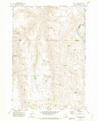
Buck Hollow and the surrounding drainage network of north-central Oregon dominate this landscape along the border of Wasco and Sherman Counties. The map documents a transition in rural infrastructure during the early 1970s, where an Old Railroad Grade winds through the southern terrain, reflecting the area's historical reliance on rail for transporting agricultural yields. A solitary Grain Elevator stands near the southwestern edge, marking a vital point of commerce for the local wheat-growing region. Numerous water sources, including Macken Springs, Kelsey Spring, and Taylor Springs, are mapped alongside named topographical features like the curiously named Wampus Cat Canyon. These springs served as critical landmarks for both cattle ranching and early travel, often connected by the network of tracks such as the Kibby Trail.
Find a feature on this map
36 named features on this map. Tap any name to fly to it.
Don’t see what you’re looking for? This feature index may not catch every label — zoom into the map to look around manually.
Map Details
Editions of this 1970 Macken Canyon Map
This is the sole edition of this map. No revisions or reprints were ever made.
Other maps of this area

1953 · The Dalles
USGS Topo · 1:250,000

1955 · Bend
USGS Topo · 1:250,000

1956 · The Dalles
USGS Topo · 1:250,000

1957 · Bend
USGS Topo · 1:250,000

1957 · The Dalles
USGS Topo · 1:250,000

1958 · Bend
USGS Topo · 1:250,000

1966 · Antelope
USGS Topo · 1:62,500

1966 · Willowdale
USGS Topo · 1:62,500

1970 · Kent
USGS Topo · 1:24,000
1971 · Bath Canyon
USGS Topo · 1:24,000