1970 Map of Kent
USGS Topo · Published 1973About this map
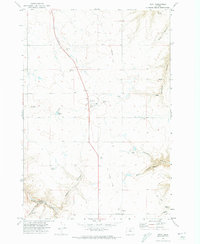
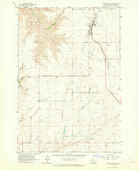
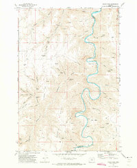
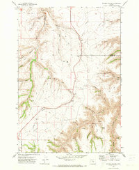
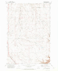
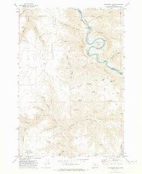
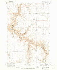
Kent stands as the primary hub of this high-plateau landscape, characterized by its agricultural infrastructure and deep drainage canyons during the early 1970s. The settlement’s role in the local wheat economy is evident through several Grain Elevator and Storage Bins facilities located along the path of the Old Railroad Grade. This transport corridor, though no longer an active rail line at the time of the survey, remains a dominant feature connecting Kent with smaller points like Bronx and Wilcox. The terrain is deeply incised by dry canyons such as Hannafin Canyon and Jackknife Canyon, which break up the horizontal expanses of ranchland. Significant genealogical and local landmarks include the IOOF Cem north of town and a second Cem near the Sherman-Wasco county line. Water management is represented by the Wilson Reservoir and various family-named springs like Holman Spring, reflecting the essential nature of water rights in this arid Oregon region.
Find a feature on this map
28 named features on this map. Tap any name to fly to it.
Don’t see what you’re looking for? This feature index may not catch every label — zoom into the map to look around manually.
Map Details
Editions of this 1970 Kent Map
This is the sole edition of this map. No revisions or reprints were ever made.
Other maps of this area

1953 · The Dalles
USGS Topo · 1:250,000

1956 · The Dalles
USGS Topo · 1:250,000

1957 · The Dalles
USGS Topo · 1:250,000
1962 · Grass Valley
USGS Topo · 1:24,000
1970 · Indian Cove
USGS Topo · 1:24,000
1970 · Macken Canyon
USGS Topo · 1:24,000
1970 · Rosebush
USGS Topo · 1:24,000

1971 · Bath Canyon
USGS Topo · 1:24,000
1971 · Horseshoe Bend
USGS Topo · 1:24,000
1971 · Bronx Canyon
USGS Topo · 1:24,000