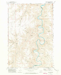
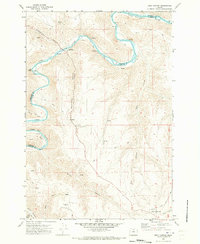
1970 Map of Indian Cove
USGS Topo · Published 1973About this map
The John Day River carves a dramatic, winding path through this high desert landscape along the border of Sherman and Gilliam counties. Surveyed in the late 1960s, the terrain is defined by a dense network of drainages such as Jackknife Canyon, Rutledge Canyon, and Little Ferry Canyon that feed toward the river's deep loops at Indian Cove and Minton Cove. The map records a landscape managed for grazing and early transit, visible in features like the Dipping Vat Trail and the remote Lon Eakin Flat. Numerous family-named and descriptive landmarks—including Point Pedicord, Wilson Point, and Adobe Point—provide essential geographic anchors for local history and genealogical research. Smaller water sources like Penny Spring and Hawkins Spring are noted throughout the canyons, highlighting the critical importance of water points in this arid river corridor.
Find a feature on this map
62 named features on this map. Tap any name to fly to it.
Don’t see what you’re looking for? This feature index may not catch every label — zoom into the map to look around manually.
Map Details
Editions of this 1970 Indian Cove Map
This is the sole edition of this map. No revisions or reprints were ever made.
Other maps of this area

1916 · Condon
USGS Topo · 1:125,000

1953 · The Dalles
USGS Topo · 1:250,000

1956 · The Dalles
USGS Topo · 1:250,000

1957 · The Dalles
USGS Topo · 1:250,000
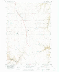
1970 · Kent
USGS Topo · 1:24,000
1970 · Shoestring Ridge
USGS Topo · 1:24,000
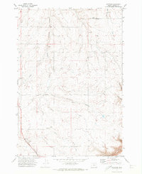
1970 · Rosebush
USGS Topo · 1:24,000
1970 · Esau Canyon
USGS Topo · 1:24,000
1971 · Moro
USGS Topo · 1:24,000
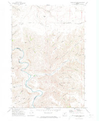
1971 · Horseshoe Bend
USGS Topo · 1:24,000