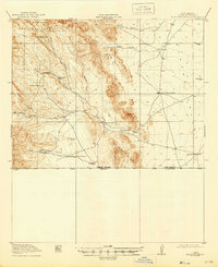
1919 Map of Antelope Wells
USGS Topo · Published 1946About this map
Culbersons Ranch and a scattering of other remote family holdings sit at the base of the Whitewater Mts in this high-desert borderland. Surveyed just before the close of the Great War, the landscape is defined by its strategic water sources and cattle-raising geography, where life centered on features like High Lonesome Wells and Nations Tank. The topography reflects a rugged transit corridor near the international boundary, marked by the historic Packers Trail winding through the San Luis Mountains.
Find a feature on this map
28 named features on this map. Tap any name to fly to it.
Don’t see what you’re looking for? This feature index may not catch every label — zoom into the map to look around manually.
Map Details
Editions of this 1919 Antelope Wells Map
2 editions found
Other maps of this area

1917 · Antelope Wells
USGS Topo · 1:62,500

1918 · Big Hatchet Peak
USGS Topo · 1:62,500

1918 · Dog Mountains
USGS Topo · 1:62,500

1918 · Walnut Wells
USGS Topo · 1:62,500

1918 · Cienega Springs
USGS Topo · 1:62,500

1918 · Animas Peak
USGS Topo · 1:62,500

1919 · Antelope Wells
USGS Topo · 1:62,500

1920 · Animas Peak
USGS Topo · 1:62,500

1923 · Walnut Wells
USGS Topo · 1:62,500

1955 · Douglas
USGS Topo · 1:250,000