
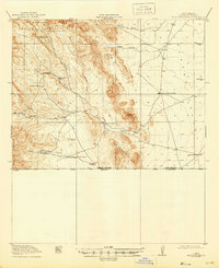
1919 Map of Antelope Wells
USGS Topo · Published 1919About this map
Isolated cattle ranches and high-desert watering points define this borderland landscape surveyed in the years leading up to 1919. The map details the rugged intersection of the San Luis Mountains and the Whitewater Mts, where survival depended on a network of scattered resources like High Lonesome Wells, McDunn's Well, and Nations Tank. Family-named outposts such as Culbersons Ranch, Lewis Ranch, and the T. Pendleton Ranch are documented along the drainage of Deer Creek, illustrating the early 20th-century ranching footprint in this corner of New Mexico.
Find a feature on this map
29 named features on this map. Tap any name to fly to it.
Don’t see what you’re looking for? This feature index may not catch every label — zoom into the map to look around manually.
Map Details
Editions of this 1919 Antelope Wells Map
2 editions found
Other maps of this area

1917 · Antelope Wells
USGS Topo · 1:62,500

1918 · Big Hatchet Peak
USGS Topo · 1:62,500

1918 · Dog Mountains
USGS Topo · 1:62,500

1918 · Walnut Wells
USGS Topo · 1:62,500

1918 · Cienega Springs
USGS Topo · 1:62,500

1918 · Animas Peak
USGS Topo · 1:62,500

1920 · Animas Peak
USGS Topo · 1:62,500

1923 · Walnut Wells
USGS Topo · 1:62,500

1955 · Douglas
USGS Topo · 1:250,000

1959 · Douglas
USGS Topo · 1:250,000