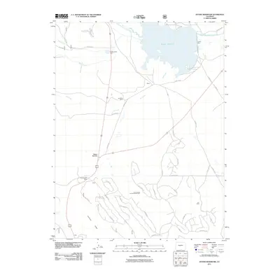
2011 Map of Antero Reservoir
USGS Topo · Published 2011About this map
Antero Reservoir dominates this high-altitude landscape in Park County, where the South Fork South Platte River is managed by Antero Dam and the smaller Buffalo Creek Dam. The area around Antero Junction serves as a critical crossroads, positioned near Trout Creek Pass and flanked by the dramatic elevation of Kaufman Ridge. This 2011 survey reveals a landscape shaped by both historic ranching and resource extraction, notably at the Salt Works Ranch and the Carson Mining and Development Mine. A dense network of rural roads with evocative names like Wagon Wheel Rd, Bridal Path Rd, and Pack Saddle Rd winds through the southern terrain, suggesting a modern layout influenced by the area's equestrian and ranching heritage near Cole Ranch.
Find a feature on this map
46 named features on this map. Tap any name to fly to it.
Don’t see what you’re looking for? This feature index may not catch every label — zoom into the map to look around manually.
Map Details
Editions of this 2011 Antero Reservoir Map
This is the sole edition of this map. No revisions or reprints were ever made.
Other maps of this area

1889 · Leadville
USGS Topo · 1:125,000

1891 · Leadville
USGS Topo · 1:125,000

1942 · Leadville
USGS Topo · 1:125,000

1953 · Denver
USGS Topo · 1:250,000

1954 · Pueblo
USGS Topo · 1:250,000

1955 · Buena Vista
USGS Topo · 1:62,500

1956 · Garo
USGS Topo · 1:24,000

1956 · Antero Reservoir
USGS Topo · 1:24,000

1956 · Antero Reservoir NE
USGS Topo · 1:24,000

1956 · Hartsel
USGS Topo · 1:24,000