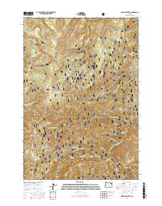
2017 Map of Anthony Butte
USGS Topo · Published 2017About this map
The Whitman National Forest dominates this landscape along the border of Union and Baker Counties, where the high country of the Blue Mountains transitions into steep river drainages. The terrain is defined by prominent peaks like Anthony Butte and High Mtn, which overlook a network of seasonal meadows and spring-fed creeks. These high-elevation clearings, including Friday Meadow and Webfoot Meadow, suggest a long history of seasonal grazing and forest management.
Find a feature on this map
64 named features on this map. Tap any name to fly to it.
Don’t see what you’re looking for? This feature index may not catch every label — zoom into the map to look around manually.
Map Details
Editions of this 2017 Anthony Butte Map
This is the sole edition of this map. No revisions or reprints were ever made.
Other maps of this area

1901 · Sumpter
USGS Topo · 1:125,000

1953 · Pendleton
USGS Topo · 1:250,000

1955 · Canyon City
USGS Topo · 1:250,000

1956 · Pendleton
USGS Topo · 1:250,000

1959 · Canyon City
USGS Topo · 1:250,000

1965 · Limber Jim Creek
USGS Topo · 1:24,000

1965 · Anthony Butte
USGS Topo · 1:24,000
1965 · Glass Hill
USGS Topo · 1:24,000
1965 · Tucker Flat
USGS Topo · 1:24,000

1965 · Little Beaver Creek
USGS Topo · 1:24,000