
1952 Map of Anthony Peak
USGS Topo · Published 1954About this map
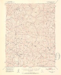
Mendocino Pass serves as a primary high-altitude crossing in this mid-century survey of the northern coastal range interior, where the boundaries of Mendocino, Tehama, Glenn, and Trinity counties converge. The landscape is defined by a dense network of high ridges, including Hammerhorn Ridge and Smokehouse Ridge, separated by deep drainage basins like those of Grindstone Creek and the Black Butte River. Significant human presence is marked by a series of isolated mountain stations and seasonal camps, such as the Log Spring Guard Sta and the Tantrum Glade Guard Station. Genealogists and local researchers will find value in the specific identification of residential and historical footprints, including the Griffin Place, Peterson Place, and several recorded former dwellings like the Henderson Cabin (Site) and Lantz Cabin (Site), which reflect the remote ranching and forest management history of the era.
Find a feature on this map
127 named features on this map. Tap any name to fly to it.
Don’t see what you’re looking for? This feature index may not catch every label — zoom into the map to look around manually.
Map Details
Editions of this 1952 Anthony Peak Map
4 editions found
Other maps of this area

1890 · Red Bluff
USGS Topo · 1:250,000

1894 · Red Bluff
USGS Topo · 1:250,000

1919 · Elk Creek
USGS Topo · 1:62,500

1926 · Covelo
USGS Topo · 1:62,500

1929 · Eden Valley
USGS Topo · 1:62,500

1931 · Hoaglin
USGS Topo · 1:96,000

1935 · Hoaglin
USGS Topo · 1:125,000

1948 · Elk Creek
USGS Topo · 1:62,500

1949 · Colyear Springs
USGS Topo · 1:62,500

1952 · Paskenta
USGS Topo · 1:62,500