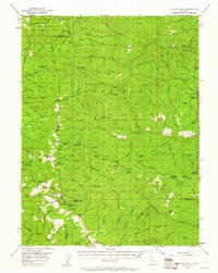
1952 Map of Anthony Peak
USGS Topo · Published 1961About this map
Anthony Peak serves as a central landmark in this high-altitude section of the Mendocino National Forest, where the borders of Tehama, Trinity, and Glenn counties converge. The 1952 field check captures a landscape defined by forest service infrastructure and remote outposts, including the Tantrum Glade Guard Station and several historic cabin sites like Henderson Cabin and Lantz Cabin. The drainage of the Middle Eel River and Thomes Creek dictates the movement through the terrain, with Mendocino Pass providing a critical crossing point for mountain travelers. The northern reach is dedicated to the Yolla Bolly Middle Eel Wilderness Area, highlighting a region maintained for its primitive character. Other notable human imprints include the Girl Scout Camp and established recreation spots like Wells Cabin Campground and Howard Lake.
Find a feature on this map
102 named features on this map. Tap any name to fly to it.
Don’t see what you’re looking for? This feature index may not catch every label — zoom into the map to look around manually.
Map Details
Editions of this 1952 Anthony Peak Map
4 editions found

Other maps of this area

1890 · Red Bluff
USGS Topo · 1:250,000

1894 · Red Bluff
USGS Topo · 1:250,000

1919 · Elk Creek
USGS Topo · 1:62,500

1926 · Covelo
USGS Topo · 1:62,500

1929 · Eden Valley
USGS Topo · 1:62,500

1931 · Hoaglin
USGS Topo · 1:96,000

1935 · Hoaglin
USGS Topo · 1:125,000

1948 · Elk Creek
USGS Topo · 1:62,500

1949 · Colyear Springs
USGS Topo · 1:62,500

1952 · Paskenta
USGS Topo · 1:62,500