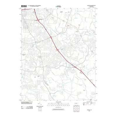
2010 Map of Antioch
USGS Topo · Published 2010About this map
Nashville International Airport dominates the northern landscape of this region, serving as a focal point for the infrastructure that defines this part of Davidson County. The settlement of Tusculum and various residential developments are tied together by a network of historic and modern thoroughfares, including Antioch Pike and Edmondson Pike. This era shows a transition from the agricultural roots of the University of Tennessee Agriculture Extension to a more suburbanized footprint, yet the natural drainage of Mill Creek and its tributaries like Sorghum Branch and Whittemore Branch still dictate the local topography.
Find a feature on this map
75 named features on this map. Tap any name to fly to it.
Don’t see what you’re looking for? This feature index may not catch every label — zoom into the map to look around manually.
Map Details
Editions of this 2010 Antioch Map
This is the sole edition of this map. No revisions or reprints were ever made.
Other maps of this area

1903 · Nashville
USGS Topo · 1:125,000

1909 · Franklin
USGS Topo · 1:62,500

1932 · Hermitage
USGS Topo · 1:62,500

1932 · Nashville
USGS Topo · 1:62,500

1942 · Lebanon
USGS Topo · 1:100,000

1949 · Franklin
USGS Topo · 1:24,000

1952 · Hermitage
USGS Topo · 1:24,000

1952 · Nashville West
USGS Topo · 1:24,000

1952 · La Vergne
USGS Topo · 1:24,000

1952 · Nashville East
USGS Topo · 1:24,000