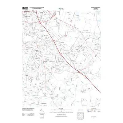
2013 Map of Antioch
USGS Topo · Published 2013About this map
Nashville International Airport dominates the northeastern landscape of this 2013 quadrangle, illustrating the significant infrastructure supporting the city's modern growth. To the southwest, the suburban expansion is evident in established communities such as Glencliff, Radnor, and Woodbine. The map captures the complex suburban residential patterns that have formed around the Mill Creek corridor, where neighborhoods like Whispering Hills and Paragon Mills are bounded by major transit arteries including I-24 and TN 155. Higher elevations like Patterson Knob and Holt Knob provide a contrast to the dense residential layouts of Tusculum and Colewood Acres. Further east, the waters of the J Percy Priest Reservoir and the rural-suburban transition of Cane Ridge and Rural Hill show the edge of the metropolitan development. This survey serves as a detailed record of the Davidson County landscape before continued 21st-century densification altered these established neighborhood boundaries.
Find a feature on this map
51 named features on this map. Tap any name to fly to it.
Don’t see what you’re looking for? This feature index may not catch every label — zoom into the map to look around manually.
Map Details
Editions of this 2013 Antioch Map
This is the sole edition of this map. No revisions or reprints were ever made.
Other maps of this area

1903 · Nashville
USGS Topo · 1:125,000

1909 · Franklin
USGS Topo · 1:62,500

1932 · Hermitage
USGS Topo · 1:62,500

1932 · Nashville
USGS Topo · 1:62,500

1942 · Lebanon
USGS Topo · 1:100,000

1949 · Franklin
USGS Topo · 1:24,000

1952 · Hermitage
USGS Topo · 1:24,000

1952 · Nashville West
USGS Topo · 1:24,000

1952 · La Vergne
USGS Topo · 1:24,000

1952 · Nashville East
USGS Topo · 1:24,000