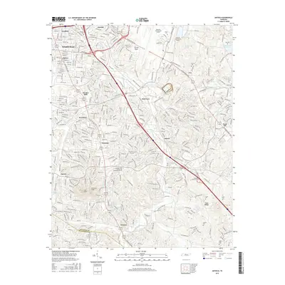
2016 Map of Antioch
USGS Topo · Published 2016About this map
Nashville International Airport dominates the northern landscape of this survey, serving as a focal point for the surrounding suburban expansion of southeast Nashville. The terrain is defined by the winding course of Mill Creek and its many tributaries, including Sorghum Branch and Whittemore Br. While modern infrastructure like Briley Pkwy and Murfreesboro Pike facilitates heavy transit, the map preserves many older markers of the community's heritage. Numerous family burial grounds, such as Whitsett Cem and Foster-Owens Cem, are interspersed between residential developments in Antioch, Una, and Cane Ridge. To the south, the landscape becomes more varied with elevations like Holt Knob and Patterson Knob rising above the creek valleys, while the J Percy Priest Reservoir forms a significant water feature on the eastern edge.
Find a feature on this map
61 named features on this map. Tap any name to fly to it.
Don’t see what you’re looking for? This feature index may not catch every label — zoom into the map to look around manually.
Map Details
Editions of this 2016 Antioch Map
This is the sole edition of this map. No revisions or reprints were ever made.
Other maps of this area

1903 · Nashville
USGS Topo · 1:125,000

1909 · Franklin
USGS Topo · 1:62,500

1932 · Hermitage
USGS Topo · 1:62,500

1932 · Nashville
USGS Topo · 1:62,500

1942 · Lebanon
USGS Topo · 1:100,000

1949 · Franklin
USGS Topo · 1:24,000

1952 · Hermitage
USGS Topo · 1:24,000

1952 · Nashville West
USGS Topo · 1:24,000

1952 · La Vergne
USGS Topo · 1:24,000

1952 · Nashville East
USGS Topo · 1:24,000