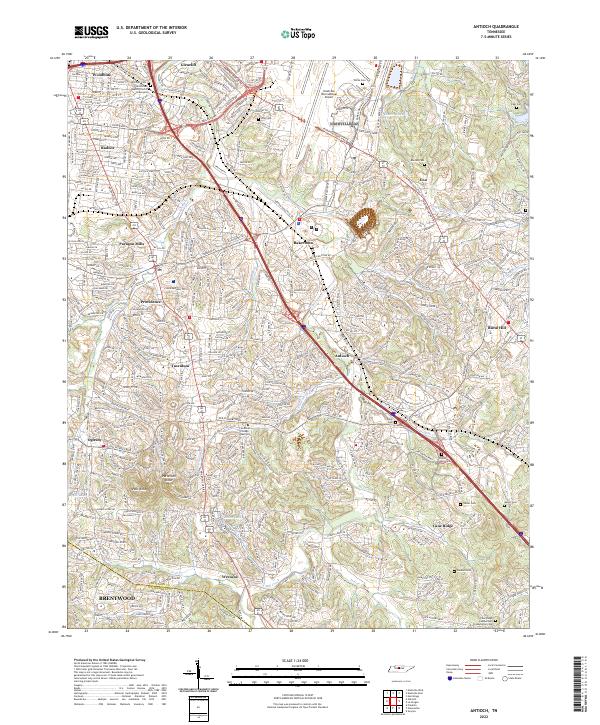
2022 Map of Antioch
USGS Topo · Published 2022About this map
Mill Creek winds through this Davidson County landscape, anchoring a corridor of historical development south of the Nashville International Airport. The geography is defined by suburban expansion along major arteries like Nolensville Pike and Murfreesboro Pike, where established communities like Woodbine and Antioch meet modern residential growth. For genealogists, the map is particularly rich in family burial grounds, including Whitsett Cem, Murrell Cem, and Foster Owens Cem, which remain as small islands of history amidst contemporary subdivisions. Cultural and religious roots are evidenced by the Mill Creek Baptist Church and the Cane Ridge Cumberland Presbyterian Cem. The terrain rises to notable high points at Holt Knob and Patterson Knob, providing a natural boundary near the Davidson and Williamson county line.
Find a feature on this map
55 named features on this map. Tap any name to fly to it.
Don’t see what you’re looking for? This feature index may not catch every label — zoom into the map to look around manually.
Map Details
Editions of this 2022 Antioch Map
This is the sole edition of this map. No revisions or reprints were ever made.
Other maps of this area

1903 · Nashville
USGS Topo · 1:125,000

1909 · Franklin
USGS Topo · 1:62,500

1932 · Hermitage
USGS Topo · 1:62,500

1932 · Nashville
USGS Topo · 1:62,500

1942 · Lebanon
USGS Topo · 1:100,000

1949 · Franklin
USGS Topo · 1:24,000

1952 · Hermitage
USGS Topo · 1:24,000

1952 · Nashville West
USGS Topo · 1:24,000

1952 · La Vergne
USGS Topo · 1:24,000

1952 · Nashville East
USGS Topo · 1:24,000
Featured Places
- Nashville, TN
- Brentwood, TN
- Huntington Ridge Estates, Nashville
- Woodbine, Nashville
- Paragon Mills, Nashville