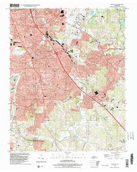
1999 Map of Antioch
USGS Topo · Published 2002About this map
Mill Creek winds through a landscape undergoing rapid suburban expansion south of the Nashville International Airport. The terrain is marked by significant elevation changes, from the prominent Holt Knob and Patterson Knob in the south to the developed neighborhoods of Woodbine and Glencliff in the north. This 1999 documentation of the Antioch area shows the dense network of modern infrastructure, including the CSX Transportation line and multiple interchanges along the major transit corridors.
Find a feature on this map
44 named features on this map. Tap any name to fly to it.
Don’t see what you’re looking for? This feature index may not catch every label — zoom into the map to look around manually.
Map Details
Editions of this 1999 Antioch Map
This is the sole edition of this map. No revisions or reprints were ever made.
Other maps of this area

1903 · Nashville
USGS Topo · 1:125,000

1909 · Franklin
USGS Topo · 1:62,500

1932 · Hermitage
USGS Topo · 1:62,500

1932 · Nashville
USGS Topo · 1:62,500

1942 · Lebanon
USGS Topo · 1:100,000

1949 · Franklin
USGS Topo · 1:24,000

1952 · Hermitage
USGS Topo · 1:24,000

1952 · Nashville West
USGS Topo · 1:24,000

1952 · La Vergne
USGS Topo · 1:24,000

1952 · Nashville East
USGS Topo · 1:24,000