
1969 Map of Antioch
USGS Topo · Published 1971About this map
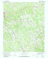
The Southern railroad line cuts a definitive diagonal through this South Carolina landscape, connecting the regional hub of Lancaster to smaller rural communities like Elgin and Pleasant Hill. The terrain is defined by a dense network of small waterways, including Hannahs Creek, Bear Creek, and Turkey Creek, which feed into the larger hydrological system surrounding the Lancaster Reservoir. This late-1960s perspective reveals a territory punctuated by traditional social centers, with numerous country churches such as Trinity Ch, St Lukes Ch, and Hopewell Ch serving as anchors for the local population.
Find a feature on this map
37 named features on this map. Tap any name to fly to it.
Don’t see what you’re looking for? This feature index may not catch every label — zoom into the map to look around manually.
Map Details
Editions of this 1969 Antioch Map
2 editions found
Other maps of this area

1941 · Spartanburg
USGS Topo · 1:250,000

1953 · Spartanburg
USGS Topo · 1:250,000

1960 · Spartanburg
USGS Topo · 1:250,000

1963 · Spartanburg
USGS Topo · 1:250,000

1964 · Spartanburg
USGS Topo · 1:250,000

1968 · Van Wyck
USGS Topo · 1:24,000

1968 · Lancaster SE
USGS Topo · 1:24,000

1968 · Heath Springs
USGS Topo · 1:24,000
1969 · Kershaw
USGS Topo · 1:24,000
1969 · Lancaster
USGS Topo · 1:24,000