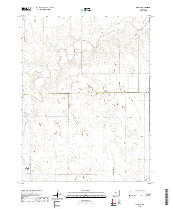
2022 Map of Anton SE
USGS Topo · Published 2022About this map
The Arikaree River meanders across the northern portion of this High Plains landscape, joined by its tributary, the North Fork Arikaree River. This area sits at the intersection of Washington County and Kit Carson County, where the terrain is marked by a systematic grid of section lines and rural roads. The mapping reveals a sparse, water-dependent topography characteristic of eastern Colorado, where the river valley provides the primary relief against the surrounding flats.
Find a feature on this map
22 named features on this map. Tap any name to fly to it.
Don’t see what you’re looking for? This feature index may not catch every label — zoom into the map to look around manually.
Map Details
Editions of this 2022 Anton SE Map
This is the sole edition of this map. No revisions or reprints were ever made.
Other maps of this area

1954 · Limon
USGS Topo · 1:250,000

1957 · Limon
USGS Topo · 1:250,000

1958 · Limon
USGS Topo · 1:250,000

1977 · Thurman
USGS Topo · 1:24,000

1977 · Arickaree
USGS Topo · 1:24,000

1977 · Anton SE
USGS Topo · 1:24,000

1977 · Cope SW
USGS Topo · 1:24,000
1978 · Anton
USGS Topo · 1:24,000
1978 · Cope NW
USGS Topo · 1:24,000

1979 · Flagler NW
USGS Topo · 1:24,000