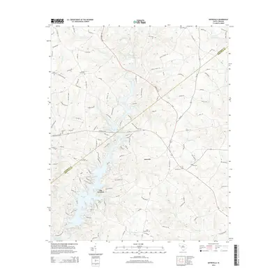
2014 Map of Antreville
USGS Topo · Published 2014About this map
Antreville stands at the crossroads of this Piedmont landscape, where the rural topography is defined by the winding waters of Lake Secession and the Rocky River. This 2014 survey documents a region deeply connected to its local heritage, evidenced by numerous historical burying grounds such as Carswell Baptist Cem and Shiloh Cem. The transition from riverine to reservoir environment is clear, with Secession Lake dominating the central terrain while the southern reaches meet the waters of Richard B Russell Lake. Cultural landmarks like Hebron Church and Asaville Church anchor the small communities along the Abbeville Hwy, while named features like Lee Shoals reflect the natural character of the watercourses before modern impoundments changed the flow of Hencoop Creek and its tributaries.
Find a feature on this map
136 named features on this map. Tap any name to fly to it.
Don’t see what you’re looking for? This feature index may not catch every label — zoom into the map to look around manually.
Map Details
Editions of this 2014 Antreville Map
This is the sole edition of this map. No revisions or reprints were ever made.
Other maps of this area

1892 · Abbeville
USGS Topo · 1:125,000

1893 · Elberton
USGS Topo · 1:125,000

1948 · Abbeville West
USGS Topo · 1:24,000

1949 · Abbeville
USGS Topo · 1:24,000

1954 · Greenville
USGS Topo · 1:250,000

1958 · Greenville
USGS Topo · 1:250,000

1964 · Iva
USGS Topo · 1:24,000

1964 · Antreville
USGS Topo · 1:24,000

1964 · Lowndesville
USGS Topo · 1:24,000

1964 · Saylors Crossroads
USGS Topo · 1:24,000