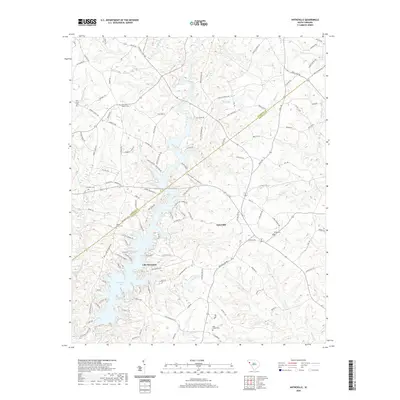
2020 Map of Antreville
USGS Topo · Published 2020About this map
Antreville serves as the central hub of this Piedmont landscape, situated near the border where Anderson and Abbeville counties meet. The geography is defined by the winding waters of the Rocky River and its numerous tributaries, including Hencoop Creek, First Creek, and Wilson Creek. In the southwestern quadrant, the terrain gives way to the expansive waters of Lake Secession, where residential developments like Secession Shores and Walkers Corner line the intricate, indented shoreline.
Find a feature on this map
124 named features on this map. Tap any name to fly to it.
Don’t see what you’re looking for? This feature index may not catch every label — zoom into the map to look around manually.
Map Details
Editions of this 2020 Antreville Map
This is the sole edition of this map. No revisions or reprints were ever made.
Other maps of this area

1892 · Abbeville
USGS Topo · 1:125,000

1893 · Elberton
USGS Topo · 1:125,000

1948 · Abbeville West
USGS Topo · 1:24,000

1949 · Abbeville
USGS Topo · 1:24,000

1954 · Greenville
USGS Topo · 1:250,000

1958 · Greenville
USGS Topo · 1:250,000

1964 · Iva
USGS Topo · 1:24,000

1964 · Antreville
USGS Topo · 1:24,000

1964 · Lowndesville
USGS Topo · 1:24,000

1964 · Saylors Crossroads
USGS Topo · 1:24,000