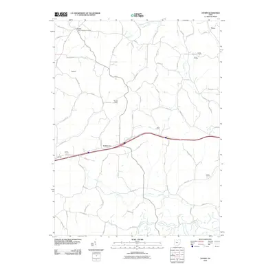
2010 Map of Antrim
USGS Topo · Published 2010About this map
Antrim and Middlebourne anchor this portion of Guernsey County, showing a landscape defined by small-scale rural settlements and numerous family and denominational burial grounds. The map captures the area during the early 21st century, where modern thoroughfares like Bridgewater Rd bisect traditional farming country. Significant genealogical value is found in the distribution of cemeteries such as the Antrim Presbyterian Cemetery, Salt Fork Baptist Cemetery, and the McCoy Cemetery, which speak to the long-standing community foundations in the region. The drainage patterns of Millers Fork, Brushy Fork, and Skull Fork converge toward the larger Salt Fork, illustrating the natural water system that likely influenced early land tracts and the placement of landmarks like the Hogback ridge. This detailed view preserves the names of secondary routes and country lanes that connect these historic points of interest.
Find a feature on this map
63 named features on this map. Tap any name to fly to it.
Don’t see what you’re looking for? This feature index may not catch every label — zoom into the map to look around manually.
Map Details
Editions of this 2010 Antrim Map
This is the sole edition of this map. No revisions or reprints were ever made.
Other maps of this area

1903 · Flushing
USGS Topo · 1:62,500

1905 · Woodsfield
USGS Topo · 1:62,500

1905 · Flushing
USGS Topo · 1:62,500

1909 · Antrim
USGS Topo · 1:48,000

1909 · Summerfield
USGS Topo · 1:62,500

1911 · Antrim
USGS Topo · 1:62,500

1911 · Summerfield
USGS Topo · 1:62,500

1949 · Clarksburg
USGS Topo · 1:250,000

1951 · Canton
USGS Topo · 1:250,000

1953 · Canton
USGS Topo · 1:250,000