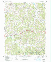
1993 Map of Antrim
USGS Topo · Published 1993About this map
Antrim and Middlebourne anchor this portion of Guernsey County, where the landscape is defined by the United States Military District Boundary running north to south through the center of the sheet. The terrain is characterized by the prominent Hogback ridge and a dense network of drainages including Salt Fork, Skull Fork, and Millers Fork. This 1993 edition, based on earlier surveys and field-checked in the early 1990s, reveals a rural landscape marked by numerous gas wells and drill holes, indicating the persistent subsurface resource extraction in the region.
Find a feature on this map
40 named features on this map. Tap any name to fly to it.
Don’t see what you’re looking for? This feature index may not catch every label — zoom into the map to look around manually.
Map Details
Editions of this 1993 Antrim Map
This is the sole edition of this map. No revisions or reprints were ever made.
Other maps of this area

1903 · Flushing
USGS Topo · 1:62,500

1905 · Woodsfield
USGS Topo · 1:62,500

1905 · Flushing
USGS Topo · 1:62,500

1909 · Antrim
USGS Topo · 1:48,000

1909 · Summerfield
USGS Topo · 1:62,500

1911 · Antrim
USGS Topo · 1:62,500

1911 · Summerfield
USGS Topo · 1:62,500

1949 · Clarksburg
USGS Topo · 1:250,000

1951 · Canton
USGS Topo · 1:250,000

1953 · Canton
USGS Topo · 1:250,000