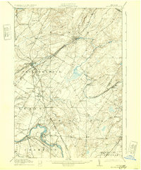
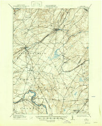
1911 Map of Antwerp
USGS Topo · Published 1932About this map
Indian River and Black River define the hydraulic and industrial character of this Jefferson County landscape during the early twentieth century. The map reveals a dense network of family-named crossroads and small agricultural settlements such as Bishops Corners, Cattail Corners, and Strickland Corners, which served the surrounding dairy and timber lands. Heavy rail infrastructure, dominated by various branches of the New York Central and Hudson River RR, connects larger hubs like Antwerp and Philadelphia to smaller milling sites. Along the southern edge, the Pine Camp Military Reservation appears alongside the industrial activity at Deferiet and Herring. Notable for genealogists are the numerous rural junctions like Devoice Corners and Gates Corners, providing a precise look at the rural habitation patterns of Northern New York before mid-century modernization altered many of these small communities.
Find a feature on this map
53 named features on this map. Tap any name to fly to it.
Don’t see what you’re looking for? This feature index may not catch every label — zoom into the map to look around manually.
Map Details
Editions of this 1911 Antwerp Map
6 editions found
Other maps of this area

1895 · Watertown
USGS Topo · 1:62,500

1898 · Watertown
USGS Topo · 1:62,500

1902 · Carthage
USGS Topo · 1:62,500

1903 · Alexandria Bay
USGS Topo · 1:62,500

1903 · Theresa
USGS Topo · 1:62,500

1904 · Carthage
USGS Topo · 1:62,500

1908 · Watertown
USGS Topo · 1:62,500

1909 · Watertown
USGS Topo · 1:62,500

1911 · Antwerp
USGS Topo · 1:62,500

1911 · Lowville
USGS Topo · 1:62,500