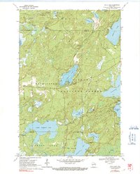
1970 Map of Anvil Lake
USGS Topo · Published 1991About this map
The Nicolet National Forest dominates this northern Wisconsin landscape, characterized by a dense concentration of glacial lakes and springs at the intersection of Vilas, Forest, and Oneida counties. This 1970 field-checked survey highlights the recreational and conservation focus of the era, marking established sites like the Anvil Lake Campground and Franklin Lake Campground. Public infrastructure for forestry and fire management is evident at the Anvil Lake Lookout Tower, positioned near the historic Military Road corridor. The intricate drainage network is anchored by Lower Ninemile Lake and Anvil Lake, with depth curves provided by the Wisconsin Department of Natural Resources to assist in understanding the underwater topography of these major water bodies. Significant wetlands and feeder streams, including Blackjack Springs and Spring Meadow Creek, connect the numerous smaller lakes such as Whispering Lake and Pat Shay Lake.
Find a feature on this map
45 named features on this map. Tap any name to fly to it.
Don’t see what you’re looking for? This feature index may not catch every label — zoom into the map to look around manually.
Map Details
Editions of this 1970 Anvil Lake Map
2 editions found
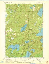
Other maps of this area

1928 · Three Lakes
USGS Topo · 1:48,000

1938 · Phelps
USGS Topo · 1:48,000

1938 · Alvin
USGS Topo · 1:48,000

1938 · Three Lakes
USGS Topo · 1:48,000

1945 · Three Lakes
USGS Topo · 1:48,000

1946 · Alvin
USGS Topo · 1:48,000

1950 · Phelps
USGS Topo · 1:48,000

1954 · Iron Mountain
USGS Topo · 1:250,000

1956 · Beechwood
USGS Topo · 1:62,500

1956 · Phelps
USGS Topo · 1:62,500