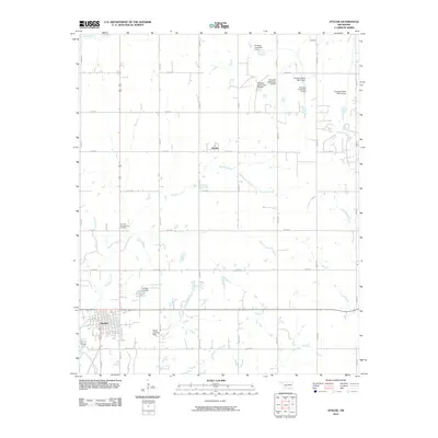
2010 Map of Apache
USGS Topo · Published 2010About this map
Apache anchors the southwestern portion of this Caddo County landscape, where the grid of rural section roads meets the winding courses of Boxelder Creek and Nunn Creek. This 2010 survey highlights a region defined by water management and tribal heritage, notably featuring the Fort Sill Apache Tribal Complex north of the main townsite. The surrounding agricultural lands are punctuated by numerous small reservoirs, including the Tonkawa Creek series with structures such as Tonkawa Creek Site 6 Dam and Tonkawa Creek Site 10 Dam.
Find a feature on this map
23 named features on this map. Tap any name to fly to it.
Don’t see what you’re looking for? This feature index may not catch every label — zoom into the map to look around manually.
Map Details
Editions of this 2010 Apache Map
This is the sole edition of this map. No revisions or reprints were ever made.
Other maps of this area

1945 · Anadarko
USGS Topo · 1:62,500

1949 · Cement
USGS Topo · 1:62,500

1949 · Elgin
USGS Topo · 1:24,000

1951 · Fort Cobb
USGS Topo · 1:62,500

1955 · Lawton
USGS Topo · 1:250,000

1955 · Clinton
USGS Topo · 1:250,000

1956 · Fletcher
USGS Topo · 1:24,000

1956 · Boone
USGS Topo · 1:24,000

1956 · Elgin
USGS Topo · 1:24,000

1956 · Richards Spur
USGS Topo · 1:24,000