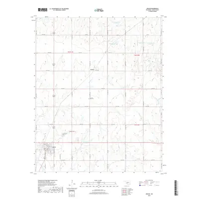
2018 Map of Apache
USGS Topo · Published 2018About this map
The town of Apache serves as the primary hub of this Caddo County landscape, characterized by a grid of agricultural section lines and water management sites. The residential layout of the town is detailed with street names including Coblake St, Lorrist Ave, and Ester Parker Rd. To the north, the small community of Stecker sits along a northern section line road, while the surrounding prairie is marked by numerous conservation structures such as Tonkawa Cr Site 10 Reservoir and Tonkawa Cr Site 3 Reservoir.
Find a feature on this map
53 named features on this map. Tap any name to fly to it.
Don’t see what you’re looking for? This feature index may not catch every label — zoom into the map to look around manually.
Map Details
Editions of this 2018 Apache Map
This is the sole edition of this map. No revisions or reprints were ever made.
Other maps of this area

1945 · Anadarko
USGS Topo · 1:62,500

1949 · Cement
USGS Topo · 1:62,500

1949 · Elgin
USGS Topo · 1:24,000

1951 · Fort Cobb
USGS Topo · 1:62,500

1955 · Lawton
USGS Topo · 1:250,000

1955 · Clinton
USGS Topo · 1:250,000

1956 · Fletcher
USGS Topo · 1:24,000

1956 · Boone
USGS Topo · 1:24,000

1956 · Elgin
USGS Topo · 1:24,000

1956 · Richards Spur
USGS Topo · 1:24,000