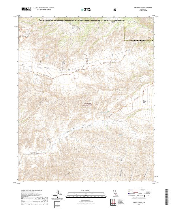
2022 Map of Apache Canyon
USGS Topo · Published 2022About this map
Los Padres National Forest covers this high-desert and mountainous landscape where the borders of Kern and Ventura counties meet. The topography is defined by significant drainage systems, including the namesake Apache Canyon and the expansive Quatal Canyon. Human access is primarily carved through the terrain via a network of specialized routes such as the Quatal Wash Ohv Trl and various segments of the Ballinger Route #22 Ohv Trl, indicating the area's modern use for off-highway recreation. Water is a critical and isolated resource in this environment, marked by named sites like Blue Rock Spring, Nettle Spring, and Mystery Spring. The presence of large, flat-topped landforms like Apache Potrero, Cowhead Potrero, and San Emigdio Mesa amidst the steep canyons illustrates the complex geological character of the Transverse Ranges at the start of the 2020s.
Find a feature on this map
34 named features on this map. Tap any name to fly to it.
Don’t see what you’re looking for? This feature index may not catch every label — zoom into the map to look around manually.
Map Details
Editions of this 2022 Apache Canyon Map
This is the sole edition of this map. No revisions or reprints were ever made.
Other maps of this area

1903 · Mt. Pinos
USGS Topo · 1:125,000

1942 · Eagle Rest Peak
USGS Topo · 1:24,000

1942 · Ballinger Canyon
USGS Topo · 1:24,000

1943 · Rancho Nuevo Creek
USGS Topo · 1:24,000

1943 · Apache Canyon
USGS Topo · 1:24,000

1943 · San Guillermo
USGS Topo · 1:24,000

1943 · Sawmill Mountain
USGS Topo · 1:24,000

1943 · Santiago Creek
USGS Topo · 1:24,000
1943 · Ballinger Canyon
USGS Topo · 1:24,000

1943 · Cuyama Peak
USGS Topo · 1:24,000