
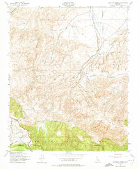
1943 Map of Santiago Creek
USGS Topo · Published 1959About this map
Los Padres National Forest anchors the southern portion of this 1940s landscape, where the high ridges of Blue Ridge meet the complex drainage systems of the San Emidio region. The topography is defined by deep incisions like Cienaga Canyon and Ballinger Canyon, showing the area just as the Army Map Service recorded it during the war years. The map tracks the winding course of Santiago Creek and its tributaries, including Bitter Creek and Muddy Creek, revealing a terrain where water sources like the isolated Spring were vital landmarks.
Find a feature on this map
10 named features on this map. Tap any name to fly to it.
Don’t see what you’re looking for? This feature index may not catch every label — zoom into the map to look around manually.
Map Details
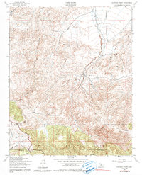
Editions of this 1943 Santiago Creek Map
3 editions found
Other maps of this area

1903 · Mt. Pinos
USGS Topo · 1:125,000

1910 · Buena Vista Lake
USGS Topo · 1:125,000

1912 · Buena Vista Lake
USGS Topo · 1:125,000

1931 · Pentland Junction
USGS Topo · 1:31,680

1931 · Hayes Ranch
USGS Topo · 1:31,680

1933 · Hayes Ranch
USGS Topo · 1:31,680

1934 · Pentland
USGS Topo · 1:31,680

1942 · Eagle Rest Peak
USGS Topo · 1:24,000

1942 · Ballinger Canyon
USGS Topo · 1:24,000

1943 · Maricopa
USGS Topo · 1:31,680