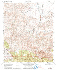
1943 Map of Santiago Creek
USGS Topo · Published 1991About this map
Santiago Creek flows through the center of this 1940s survey, carving a path between the northern desert-fringe terrain and the southern timberlands. The landscape transitions sharply at the Kern Co Ventura Co line, where the lower elevations give way to the protected highlands of the Los Padres National Forest. This document captures the remote character of the San Emidio region just as photogrammetric mapping began to replace manual field surveying. Notable relief features such as Blue Ridge and Ballinger Canyon define the southern half of the quadrangle, while the northern reaches are marked by the drainage systems of Bitter Creek and Cienaga Canyon. The map reveals a network of unimproved dirt roads and trails that provided the only access to this high-altitude border country during the early war years.
Find a feature on this map
12 named features on this map. Tap any name to fly to it.
Don’t see what you’re looking for? This feature index may not catch every label — zoom into the map to look around manually.
Map Details
Editions of this 1943 Santiago Creek Map
3 editions found

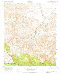
Other maps of this area

1903 · Mt. Pinos
USGS Topo · 1:125,000

1910 · Buena Vista Lake
USGS Topo · 1:125,000

1912 · Buena Vista Lake
USGS Topo · 1:125,000

1931 · Pentland Junction
USGS Topo · 1:31,680

1931 · Hayes Ranch
USGS Topo · 1:31,680

1933 · Hayes Ranch
USGS Topo · 1:31,680

1934 · Pentland
USGS Topo · 1:31,680

1942 · Eagle Rest Peak
USGS Topo · 1:24,000

1942 · Ballinger Canyon
USGS Topo · 1:24,000

1943 · Maricopa
USGS Topo · 1:31,680