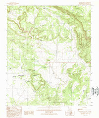
1989 Map of Apache Gap
USGS Topo · Published 1989About this map
Middle Mesa and the sweeping plateau of Mesa Apache dominate this high-desert terrain in San Miguel County. The landscape is defined by its water management, featuring a network of livestock tanks such as Boggy Tank, Calicito Tank, and East Tank, which supported the region's ranching economy. Settlement patterns are sparse, focusing on the isolated community of Lagunita and the historic location at Aurupa (Site), reflecting the area's transition between communal land grants and national forest administration.
Find a feature on this map
21 named features on this map. Tap any name to fly to it.
Don’t see what you’re looking for? This feature index may not catch every label — zoom into the map to look around manually.
Map Details
Editions of this 1989 Apache Gap Map
This is the sole edition of this map. No revisions or reprints were ever made.
Other maps of this area

1954 · Tularosa
USGS Topo · 1:250,000

1955 · Las Cruces
USGS Topo · 1:250,000

1958 · Las Cruces
USGS Topo · 1:250,000

1958 · Tularosa
USGS Topo · 1:250,000

1959 · Engle
USGS Topo · 1:62,500

1959 · Upham
USGS Topo · 1:62,500

1961 · Caballo
USGS Topo · 1:24,000

1961 · Williamsburg
USGS Topo · 1:24,000

1961 · Garfield
USGS Topo · 1:24,000

1979 · Truth or Consequences
USGS Topo · 1:100,000