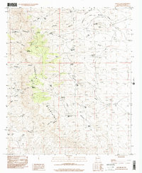
1996 Map of Apache Gap
USGS Topo · Published 2001About this map
The Caballo Mountains dominate this high-desert landscape in Sierra County, defining a region of sharp relief and seasonal water management. The terrain is marked by numerous peaks including Timber Mountain, Lone Mountain, and Brushy Mountain, providing a backdrop for a complex system of drainage and ranching infrastructure. Throughout the quadrangle, dozens of livestock water sources such as Ghost Tank, L 7 Red Tank, and Apache Gap Tank demonstrate the critical importance of water storage in this arid environment.
Find a feature on this map
37 named features on this map. Tap any name to fly to it.
Don’t see what you’re looking for? This feature index may not catch every label — zoom into the map to look around manually.
Map Details
Editions of this 1996 Apache Gap Map
This is the sole edition of this map. No revisions or reprints were ever made.
Other maps of this area

1954 · Tularosa
USGS Topo · 1:250,000

1955 · Las Cruces
USGS Topo · 1:250,000

1958 · Las Cruces
USGS Topo · 1:250,000

1958 · Tularosa
USGS Topo · 1:250,000

1959 · Engle
USGS Topo · 1:62,500

1959 · Upham
USGS Topo · 1:62,500

1961 · Caballo
USGS Topo · 1:24,000

1961 · Williamsburg
USGS Topo · 1:24,000

1961 · Garfield
USGS Topo · 1:24,000

1979 · Truth or Consequences
USGS Topo · 1:100,000