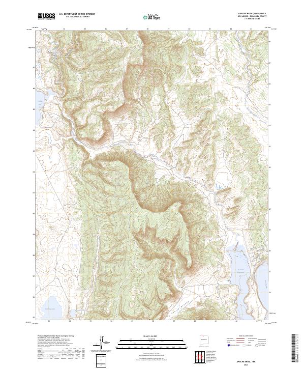
2023 Map of Apache Mesa
USGS Topo · Published 2023About this map
Apache Mesa rises above a high-desert landscape defined by its vital water sources and dramatic landforms. In this part of Rio Arriba County, the Rio Chama feeds the prominent El Vado Reservoir at the southeastern edge of the map, while the western reaches are dotted with distinct basins including Stone Lake, Hayden Lake, and Stinking Lake. The drainage network of Boulder Creek and Horse Lake Creek cuts through the terrain, illustrating the natural flow towards the Chama river valley.
Find a feature on this map
20 named features on this map. Tap any name to fly to it.
Don’t see what you’re looking for? This feature index may not catch every label — zoom into the map to look around manually.
Map Details
Editions of this 2023 Apache Mesa Map
This is the sole edition of this map. No revisions or reprints were ever made.
Other maps of this area

1954 · Aztec
USGS Topo · 1:250,000

1955 · Chama
USGS Topo · 1:62,500

1955 · Lumberton
USGS Topo · 1:62,500

1955 · Tierra Amarilla
USGS Topo · 1:62,500

1955 · Boulder Lake
USGS Topo · 1:62,500

1958 · Aztec
USGS Topo · 1:250,000

1962 · Aztec
USGS Topo · 1:250,000

1965 · Aztec
USGS Topo · 1:250,000

1981 · Chama
USGS Topo · 1:100,000
1983 · Pounds Mesa
USGS Topo · 1:24,000