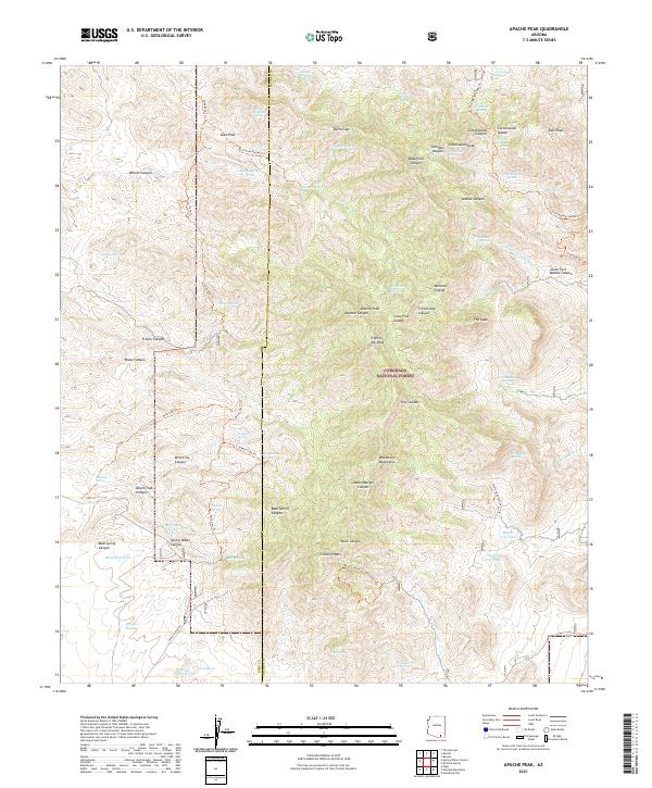
2021 Map of Apache Peak
USGS Topo · Published 2021About this map
The Whetstone Mountains dominate this high-desert landscape within the Coronado National Forest, where steep canyons and significant peaks define the border between Pima and Cochise counties. Named summits like Apache Peak and Granite Peak overlook a complex network of water sources, essential for survival and livestock in this arid environment. The map documents numerous cattle-rearing features such as McNalley Tank, Boulder Tank, and Great Spring Tank, alongside dozens of natural seeps like Apache Spring and Blacktail Spring.
Find a feature on this map
77 named features on this map. Tap any name to fly to it.
Don’t see what you’re looking for? This feature index may not catch every label — zoom into the map to look around manually.
Map Details
Editions of this 2021 Apache Peak Map
This is the sole edition of this map. No revisions or reprints were ever made.
Other maps of this area

1904 · Patagonia
USGS Topo · 1:125,000

1905 · Patagonia
USGS Topo · 1:125,000

1915 · Benson
USGS Topo · 1:125,000

1926 · Whetstone
USGS Topo · 1:62,500

1932 · Elgin
USGS Topo · 1:62,500

1938 · Huachuca
USGS Topo · 1:62,500

1940 · Elgin
USGS Topo · 1:62,500

1943 · Benson
USGS Topo · 1:125,000

1947 · Elgin
USGS Topo · 1:62,500

1948 · Elgin
USGS Topo · 1:24,000