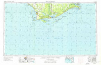
1957 Map of Apalachicola
USGS Topo · Published 1976About this map
The Apalachicola River flows through the heart of the Florida Panhandle's Forgotten Coast, anchoring a region defined by its complex network of barrier islands and expansive wetlands. This mid-century survey captures the area during a period of established coastal industry, where the Apalachicola Northern railroad links the timber and maritime hubs of Apalachicola and Port St Joe. Navigation is a primary theme, with the Intracoastal Waterway cutting through Lake Wimico and the Gulf County Canal, while the Cape St George Lighthouse and St Joseph Point Light mark the hazardous transitions from the Gulf of Mexico to sheltered sounds. Inland, the vast Apalachicola National Forest and Bear Swamp illustrate the wilderness character of Liberty and Franklin counties, contrasting with coastal developments like Mexico Beach and Lanark Village.
Find a feature on this map
79 named features on this map. Tap any name to fly to it.
Don’t see what you’re looking for? This feature index may not catch every label — zoom into the map to look around manually.
Map Details
Editions of this 1957 Apalachicola Map
2 editions found

Other maps of this area

1940 · Arran
USGS Topo · 1:62,500

1943 · Arran
USGS Topo · 1:62,500

1943 · St Joseph Spit
USGS Topo · 1:31,680

1943 · Beacon Beach
USGS Topo · 1:31,680

1943 · Port St. Joe
USGS Topo · 1:31,680

1943 · Cape San Blas
USGS Topo · 1:31,680

1943 · Dog Island
USGS Topo · 1:31,680

1943 · West Pass
USGS Topo · 1:31,680

1943 · Overstreet
USGS Topo · 1:31,680

1943 · Apalachicola
USGS Topo · 1:31,680